Back Ilala (distrito sa Tansaniya) CEB Ilala (Distrikt) German Περιοχή Ιλάλα Greek Ilala Spanish District d'Ilala French Distretto di Ilala Italian Ilala (distrikt) NB Wilaya ya Ilala Swahili Ilala Turkish Ilala (huyện) Vietnamese
Ilala District
Halimashauri ya Manispaa ya Ilala (Swahili) | |
|---|---|
|
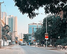
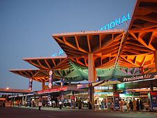
From top to bottom: Street scene in Ilala, Julius Nyerere International Airport & High rises on Ohio Street in Ilala | |
| Nickname: The leading district | |
 Ilala District in Dar | |
| Coordinates: 6°55′39.36″S 39°8′0.96″E / 6.9276000°S 39.1336000°E | |
| Country | |
| Region | Dar es Salaam Region |
| District | 1 February 2001 |
| Capital | Mchafukoge |
| Area | |
| • Total | 364.9 km2 (140.9 sq mi) |
| • Rank | 2nd in Dar |
| Highest elevation (Nzasa,Chanika) | 250 m (820 ft) |
| Population (2022 census)[1] | |
| • Total | 1,649,912 |
| • Rank | 1st in Dar |
| • Density | 4,500/km2 (12,000/sq mi) |
| Demonym | Ilalan |
| Ethnic groups | |
| • Settler | Swahili |
| • Native | Zaramo |
| Time zone | UTC+3 (EAT) |
| Tanzanian Postcode | 121 |
| Website | Official website |
| Symbols of Tanzania | |
| Bird | |
| Fish | |
| Mammal | |
Ilala District, officially the Ilala Municipal Council (Halimashauri ya Manispaaa ya Ilala, in Swahili) is one of five districts of the Dar es Salaam Region of Tanzania. The district is bordered to the north and northeast by Kinondoni District and Ubungo District, to the east by the Zanzibar Channel, the west by Pwani Region, and to the south by the Temeke District. It covers an area of 364.9 km2 (140.9 sq mi).[2] The district is comparable in size to the land area of U.S Virgin Islands.[3] The administrative seat is Mchafukoge. The 2012 National Tanzania Census states the population for Ilala as 1,220,611.[4]
- ^ Citypopulation.de Population of Ilala Municipality
- ^ "Tanzania: Northern Zone(Districts and Wards) - Population Statistics, Charts and Map".
- ^ 347 km2 (134 sq mi) for U.S Virgin Islands at "Area size comparison". Nation master. 2022. Retrieved 11 March 2023.
- ^ "2012 Population and Housing Census General Report" (PDF). Government of Tanzania. Retrieved 2021-11-19.


